


The Channels Retreat Welcomes Hikers and Those Who Appreciate The Natural Beauty of the Outdoors
Scroll Down to View A Vistor’s Guide to Outdoor Experiences Unique to the Area
Coming to unplug but also want to experience the great outdoors?
Great.
The Cabin is in proximity to beautiful hikes, lakes, rock climbing, bird watching, world class trout fishing and Amazing State Parks.

Hiking Brumley Mountain
The Brumley Mountain Trail runs all the way from Hayter's Gap to Hidden Valley Lake off of US-19 in Moccasin Gap. Step right outside of the front door at The Channels Retreat and you will be greeted by the trail's most heavily used 2 miles that travel to the Great Channels of Virginia.
The Channels are a series of deep sandstone crevices worn into sandstone outcrops on the mountain's summit and form one of Virginia's most fascinating ecosystems.
It is possible to easily walk within the maze-like channels, which harbor an almost cave-like microclimate and often hold snow cover long after temperatures have risen above freezing. Coupled with outstanding views from the top of these outcrops and a firetower on Middle Knob's summit, this hike forms one of southwest Virginia's most scenic and popular hiking destinations.
Cabin is Located 2 miles from the Channels Natural Area Preserve. We encourage every guest to enjoy this beautiful hike - No driving from the Cabin necessary!
400 Million Year Old Great Channels of Virginia …..
Part of the Channels Natural Area Preserve

The entrance to the Channels

The view looking up from inside the Channels

In awe of the natural beauty

The trail to the firetower

Another view from inside

Deciding which way to go...

Exploring nature's wonder

Some spaces are narrow

One of Virginia's most fascinating natural wonders

“Natural History: Named for a towering rock outcrop known locally as The Pinnacle, this preserve has an assortment of geological features derived from the underlying bedrock. The Pinnacle is a sheer spire of dolomite nearly 400 feet tall that was created by the dissolving action of groundwater in combination with down-cutting of the gorge by Big Cedar Creek. Big Falls, an impressive waterfall in Big Cedar Creek, is formed where the creek passes over several layers of erosion-resistant sandstone.”
Pinnacle Natural Area Preserve 776 acres – Russell County, Virginia

Big Falls

Swinging Bridge
Location: The preserve is in southwestern Virginia, about 25 miles north of Abingdon. From I-81 at Abingdon, take ALT 58 west through town to U.S. Route 19 north. Go about 20 miles to Business 19 into Lebanon. At the second light, turn left on Route 82 west. Go 1.1 mile to Route 640 (River Mountain Road) and turn right. Go 4.2 miles and turn left on Route 721 (a gravel road). Go 0.8 mile to the parking area on the left.

Clinch Mountain Wildlife Management Area
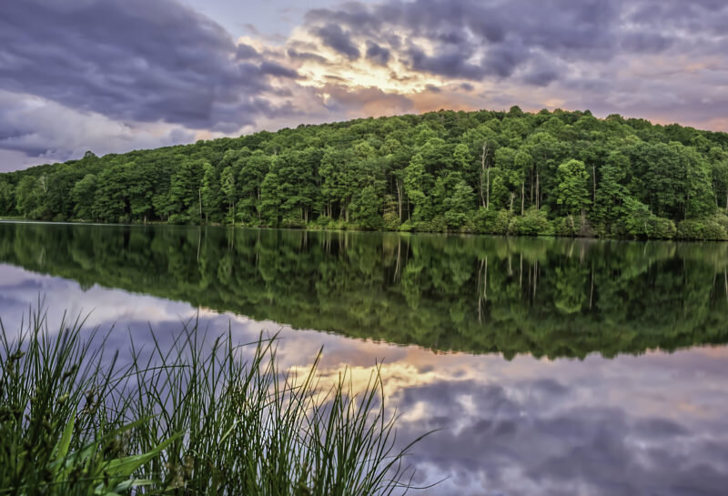
Hidden Valley Lake
Do you love hiking, fishing, or rock climbing? This is the perfect place for you!
Fishing:
Hidden Valley Lake supports populations self-sustaining populations of largemouth bass, bluegill, redbreast sunfish, and black crappie. Channel catfish and northern pike are stocked.
Climbing
Hidden Valley is a sandstone cliff band ranging up to about 70 feet high. The climbing is mostly face climbing, with some large roofs, corners and aretes thrown in for good measure.
Access permit Required, a valid Virginia fishing or Virginia hunting license will suffice otherwise permits are available via https://dwr.virginia.gov/waterbody/hidden-valley-lake/

Laurel Bed Lake
Laurel Bed is located on the Clinch Mountain Wildlife Management Area. This 330-acre lake rests on the top of Clinch Mountain at 3600 feet of elevation. This nearby lake is a outdoor enthusiast dream, not only does it offer great kayaking but it is also filled with rock, and small mouth bass. Bring your fly rod as it has significant numbers of brook trout and pan fish too. A small fee access permit is required however this is less than $5.

Big Tumbling Creek
Big Tumbling Creek is a large, steep gradient stream with numerous small waterfalls and large, deep rocky pools. The Clinch Mountain fee fishing area (Tumbling Creek) offers put-and-take trout fishing with the added advantage that trout are stocked several times per week throughout the season. The fee fishing program operates from the first Saturday in April through September at Clinch Mountain. For those anglers who miss the opening day of trout season, the fee fishing area still provides this opportunity on the first Saturday in April when it opens at 9:00 AM During the fee fishing season, a daily permit ($8.00) is required in addition to a valid Virginia freshwater fishing license.

The Devils Bathtub.
Devil’s Fork Loop Trail is perfect for the true back country enthusiasts who are willing to get their feet wet. This 3.5 mile hike in nearby Dungannon takes you across more than 15 water-crossings to see a series of small waterfalls and swimming holes. All hikers should be prepared to scramble over boulders, and should plan their visit during relatively low water conditions. The highlight of the trail is the spectacular Devil’s Bathtub, a naturally smooth sandstone formation in the stream bed making a natural swimming hole.

Breaks Interstate Park
Known as the “Grand Canyon of the South”, Breaks Interstate Park is a bi-state state park located partly in southeastern Kentucky and mostly in southwestern Virginia, in the Jefferson National Forest, at the northeastern terminus of Pine Mountain.
It is one of several interstate parks in the United States, but only one of two operated jointly by two states rather than as two separate state park’s.

Clinch Mountain Wildlife Preserve
Clinch Mountain Wildlife Management Area is open to the public for hunting, trapping, fishing, hiking, boating, and primitive camping, although some interior roads are seasonally closed. Other amenities include a sighting-in range for firearms, an archery shooting range. Laurel Bed Lake, a 330-acre reservoir, is located within the area, in addition to Big Tumbling Creek and several of its tributaries.

Bristol Caverns
Far below the earth's surface, in the timeless beauty of Bristol Caverns, a strange and exciting experience awaits you.
Paved, well lighted walkways wind through the vaulted chambers and along the banks of the ancient Underground River that carved these remarkable caverns from the hard core of the earth 200 to 400 million years ago. In the frontier days, Indians used the Underground River as an attack and escape route in their raids on settlers. Stealing into the area by way of the Underground River and the caverns, they swooped down on unsuspecting families, then disappeared as if swallowed up by the earth.

The Ralph Stanley Museum
The Ralph Stanley Museum and Traditional Mountain Music Center opened its doors in October 2004, providing a truly unique museum experience for music lovers. Stop by and take an interactive musical journey through the career of Dr. Ralph Stanley and the history of traditional mountain music right here where it all started - the beautiful mountains of southwest Virginia.
